
Cherry Hill Street Directory Walkthrough
Start a Cherry Hill Township street directory search with a physical address, then move to the parcel identifier and the records tied to it. The public map supplies street and tax-map context. Assessment material can provide current owner, assessment, and sales context. The Camden County Clerk index can then connect recorded parties and instruments to the municipality and legal description. A voter list has a much narrower role: state law describes a street-arranged certified list, but protected addresses and other limits mean it is not a household census.
- Enter the exact address in the USPS ZIP Lookup and retain the standardized mailing form alongside the original address.
- Find the address or block and lot in the Cherry Hill Public Information Map. Record the map date, visible road context, and parcel label.
- Compare the parcel with the county assessment route for owner, assessment, and sales context. Treat an assessed owner as a property record, not proof of who is present at the address.
- Search the Camden County Clerk property index for the legal description and related parties, then read nearby recorded instruments.
- For a dated household question, use a street-arranged public voter list only within its statutory limits and pair it with dated library or archival material.
Keep each result dated. The same street can hold parcels with different ownership structures, and a change in a mailing address does not establish a move into or out of Cherry Hill Township.
Cherry Hill Address Record Routes
Several official systems use an address, road, block, lot, or legal description, but they answer different questions. The street directory is strongest when the record type stays visible. The Clerk index is an instrument trail. GIS is geographic context. SDL is a property and permit route. Election records have statutory public-list limits. None alone names every person connected with a street.
| Address-keyed source | Keeper | What it can show | Access and limit |
|---|---|---|---|
| Public Information Map | Cherry Hill Township | Tax-map context, streets, parcels, parks, schools, and amenities | Public viewer; record map version and date |
| Assessment Data Hub | Camden County Board of Taxation | Assessment, owners, and sales data | Exact live search controls were not verified |
| Property and permit portal | Cherry Hill Township SDL route | Address, street, block/lot, and permit context | Not all permits are available; some features require login |
| Recorded property index | Camden County Clerk | Recorded parties, instruments, municipality, and legal-description trail | Online index is 1978 to present and updates nightly |
| Certified voter list | Camden County elections route | Name, address, date of birth, party affiliation, and voting history | Public fields are set by statute; signatures and protected addresses are excluded |
The County Board of Taxation also describes mapping, land details, specific-property work, and a 200-foot-list route. A 200-foot list is not the same as a GIS adjacency view, and the reviewed material does not establish its exact current delivery fields.
Cherry Hill Streets on the Public Map
The township GIS and Mapping page points to a township-wide Public Information Map with tax maps, parks, playgrounds, schools, and amenities. Use the visible search and map controls to place an address in its road and parcel setting. Zooming along a road is useful for checking parcel geometry and labels before comparing assessment or Clerk results. It is not a verified way to create a complete list of people for the street.
The Cherry Hill Public Information Map is shown below with the parcel and map environment used for street research.
Use the visible map result as a dated geographic reference, then confirm a parcel detail through the relevant property or recorded-instrument source.
Map currency matters. A 2026 township procurement describes maintenance of five key maps, roughly 238 individual plates, and about 26,993 line items or parcels to reflect 2025 conditions. Those figures describe the maintenance scope, not a promise that every public-map field or search option is available online.
Note: Save the road name, block or lot, plate context, visible date, and source URL before comparing results from another portal.
Camden Assessment Context by Street
The Camden County Board of Taxation describes its assessment search as covering assessment, owners, and sales data. That makes it a practical next check after the public map identifies a parcel. The research did not capture the Tax Data Hub’s exact field labels, municipality choice, owner-name control, or sales filters. A careful street directory search should therefore use only the confirmed categories and avoid assuming an address, owner, or ZIP filter exists.
The Camden assessment-data hub is the official route described for those categories.
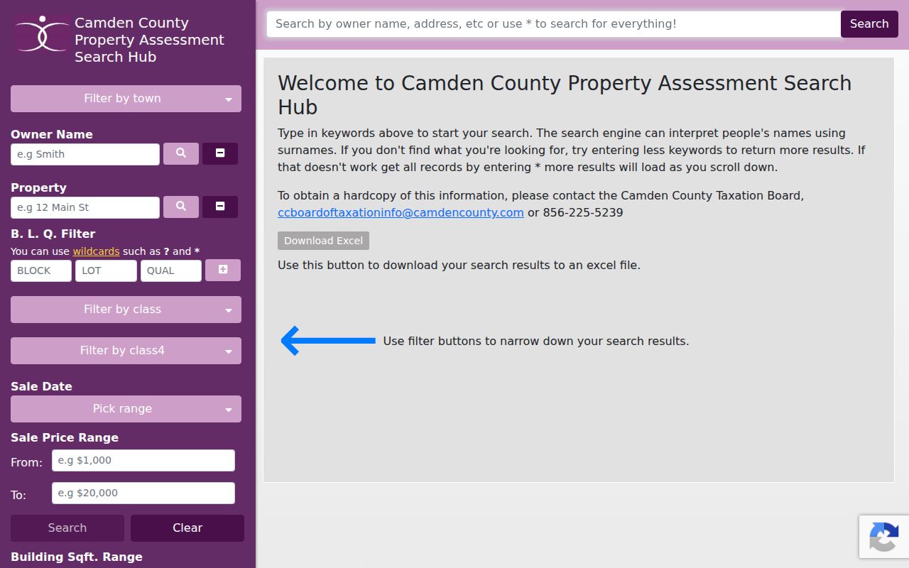
The screenshot supports the assessment route, while the unverified controls should be checked on the live screen before a search method is repeated.
An owner mailing address, if exposed in a property record, can differ from the situs address. The situs is the physical location used in GIS and permit work. A mailing address is correspondence information. Keeping those values separate prevents a street result from being overstated.
Cherry Hill Permit Searches by Address
The township’s SDL property and permit route gives the street directory a documented address search path beyond assessment data. Its advanced search lists Properties and Permits tabs, street or street address, block and lot, permit or control number, location, keywords, work type, permit status, proposed-use group, and issued-date options. The published tips call for a full address, suggest omitting a street type when needed, allow partial permit numbers, and limit keywords to three comma-separated terms.
| SDL field or filter | Use in a Cherry Hill street search | Verified note |
|---|---|---|
| Street or street address | Start with the physical location | Documented on the advanced screen |
| Block and lot | Connect a parcel to a permit search | Qualifier is available for property searches |
| Permit or control number | Return to a known filing | Partial number is supported |
| Work type, status, use group, date | Narrow a permit question | Issued timeframe, on/after, and on/before options are listed |
The SDL advanced search presents the property and permit options used for this kind of location-based check.
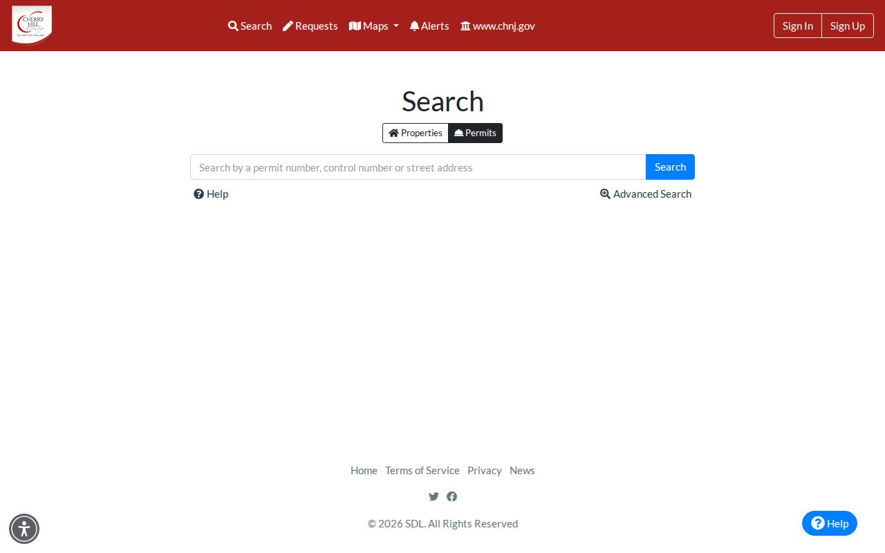
SDL itself cautions that not all permits are available, so an empty result should not be treated as proof that no work or administrative record exists.
Recorded Deeds Along Cherry Hill Streets
The Camden County Clerk online property-records route covers the recorded-property index from 1978 to the present, with nightly updates. Free basic access is available, while broader document classes are associated with premium access. Search the legal description and party-name variants, then read the chain around a known transfer. Grantor means the party conveying an interest. Grantee means the party receiving it. Either role can be an estate, trust, business, lender, or co-owner rather than a current resident.
The Clerk’s free property-record search is the starting screen for the recorded-instrument portion of the street directory.
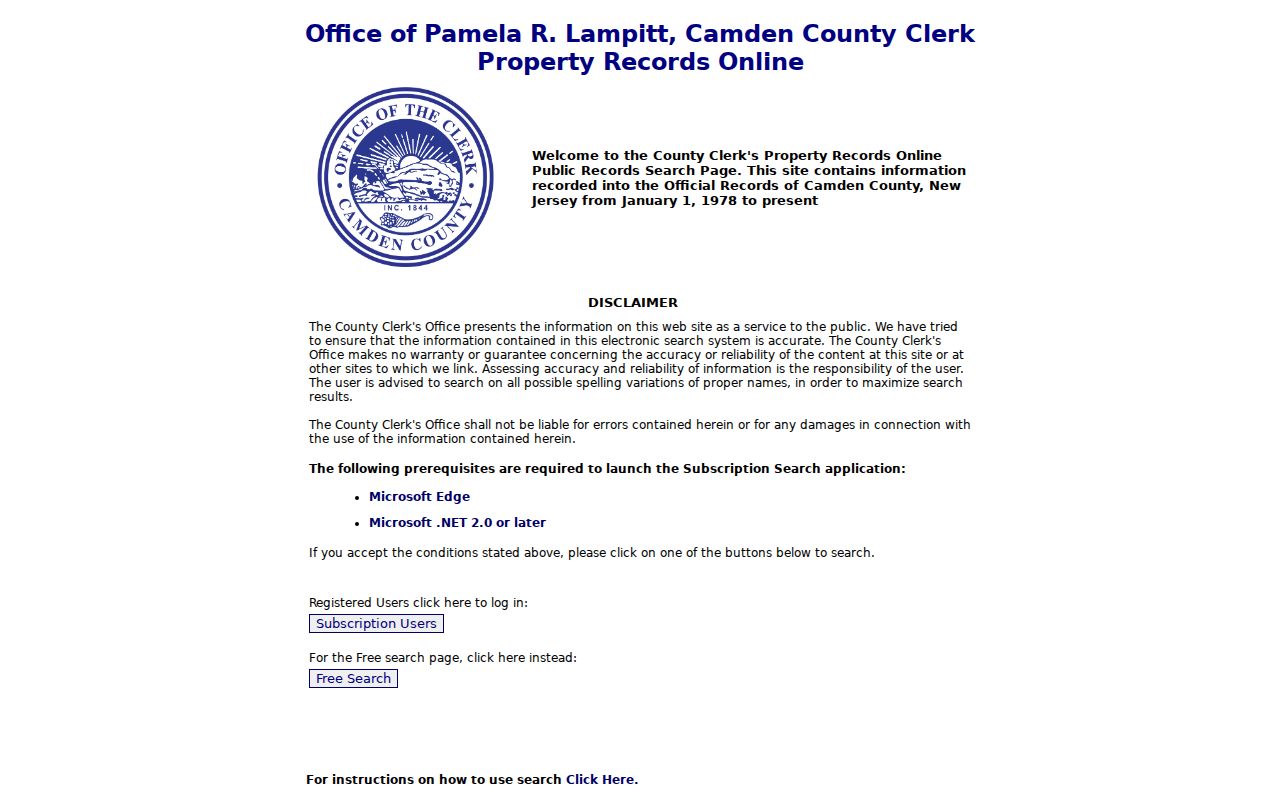
Match a result to the municipality, parcel, legal description, adjacent instruments, and date before treating it as part of the same property chain.
For earlier deeds, the modern online index is not the answer. The New Jersey State Archives finding aid describes Camden deed books from 1844 through 1900 and index formats reaching 1912 in the identified series. County office, Archives, and Camden County Historical Society routes fill the earlier research gap.
Cherry Hill Address Record Terms
Address records use several labels for the same place. Reading them correctly avoids merging a delivery address with a parcel or a deed description. These definitions also make it easier to compare a current street result with an older map or recorded instrument.
- Parcel
- A mapped unit of land used in tax-map and assessment context. A parcel identifier is a bridge between map, assessment, and deed work.
- Situs address
- The physical location used by GIS, permit, and assessment research. It may not match an owner’s mailing address.
- Legal description
- The deed or index language that identifies land by municipality, block, lot, tract, or metes-and-bounds reference.
- Plat
- A recorded map that can show a subdivision, lots, roads, or easements. It is an instrument or map record, not a resident list.
- Criss-cross directory
- A reverse-style historical directory organized by address. Its dated entries belong with the historical collections, not as current occupancy proof.
Historical research needs an additional name: Delaware Township. Cherry Hill adopted its present name in 1961, so an older deed, map, or newspaper may use the earlier township name even when the land is now in Cherry Hill Township.
Street-Arranged Voter Records in Cherry Hill
New Jersey law describes a public certified voter list arranged by street, residence number, and name. Its stated public fields are name, address, date of birth, political-party affiliation, and voting history. The law also excludes signatures unless a court orders disclosure. That makes a certified list a limited, dated civic record, not a substitute for a parcel record or proof of every person at an address.
The official New Jersey Am I Registered? lookup is separate from a public list request. Its live fields were not captured in the research. For a current list type, format, date of extract, fee, and redaction policy, contact Camden County Voting and Elections before requesting a narrowly described record.
Protected voters may omit a street address under state law. Inactive, moved, and deceased updates can also create timing differences. A voter result never reveals a ballot choice.
Note: Treat a blank or absent voter address as a privacy or timing issue, not evidence that a person has left the street.
Older Cherry Hill Street Names
Historic street work often begins before a ZIP code existed and before the township used its present name. Search Delaware Township as well as Cherry Hill, then add a village or neighborhood term when the record is dated. CHPL local history identifies names such as Colestown, Ellisburg, Erlton, Colwick, Locustwood, Kingston Estates, Greenhaven, Barclay Farms, and Cherry Hill Estates as useful research vocabulary. They are clues for newspapers, maps, and directories, not verified legal boundaries.
The historical shelf belongs with the Cherry Hill Township city directory collections, where dated directory and newspaper holdings can help bracket an older address. For a street match, compare intersections, neighboring owner labels, block and lot, legal description, and map plate instead of assuming a modern spelling appears in an older source.
Camden County Historical Society holds owner-labeled maps from 1856, 1877, 1886, 1902, and 1907, plus Sanborn maps for 1913 through 1925. Those maps can place an earlier property in context, but an owner label is still a date-specific record.
Standardizing a Cherry Hill Street Address
Before comparing portals, run the current mailing address through the USPS lookup using the required street address and city and state fields. A company field is optional. Keep the original form from a deed, newspaper, or old directory beside the USPS result rather than overwriting it. Standardized postal output helps search current address systems, but it does not decide property ownership or municipal jurisdiction.
For a historical source, record the original road spelling, township name, village or route language, date, map or block reference, and source page. Pre-1963 records may use a village, rural route, or Delaware Township with no ZIP. That small worksheet protects a street directory search from losing the very wording needed to find the next record.
Limits of a Cherry Hill Street Search
Property systems document parcels and recorded interests. Permit systems document selected administrative activity. Voter material has statutory public fields and protected-address limits. None guarantees a complete list of current occupants, relatives, utility users, or private contacts on a road. The research did not locate public utility customer lists, a complete neighborhood membership roster, or a verified current school-attendance address finder.
When a public result is missing, the documented fallback is the relevant custodian: the municipal Clerk’s OPRA request route for identified non-exempt township records, the Camden County office for county-held records, or the Archives and library path for older material. A precise address, record type, and date range gives each request a clearer scope.