
Cherry Hill ZIP Code Directory Coverage
A township document identifies three ZIP codes for Cherry Hill Township: 08002, 08003, and 08034. That statement establishes township coverage, but it does not publish precise neighborhood edges for each ZIP. The right way to use these codes is as postal routing and search context, then confirm the exact street address in the current postal lookup and the parcel in the municipal or county records system.
| ZIP | Areas Covered | Post Office | Notes |
|---|---|---|---|
| 08002 | Cherry Hill Township mailing coverage; exact local edge not published in the reviewed source | Ellisburg USPS station | Township-listed ZIP; Ellisburg station uses 08002-3372 |
| 08003 | Cherry Hill Township mailing coverage; exact local edge not published in the reviewed source | Specific station not identified in the reviewed source | Township-listed ZIP; do not infer a neighborhood boundary from routing examples |
| 08034 | Cherry Hill Township mailing coverage; exact local edge not published in the reviewed source | Cherry Hill Post Office on MarlKress Road | Township-listed ZIP; post-office listing uses 08034-9998 |
The reviewed sources did not establish a PO-box-only or unique ZIP for the township. A special address should be checked in the live postal tool rather than added to a postal coverage list from an assumption.
USPS Fields for Cherry Hill ZIP Codes
The official USPS ZIP Lookup offers By Address, By City & State, and Cities by ZIP modes. By Address is the useful starting mode for an exact Cherry Hill Township location. It provides a standardized mailing result, not a person or company confirmation. Preserve a historical spelling in a separate note when comparing an old deed, newspaper, or directory entry.
| USPS field or mode | Requirement shown in research | Use |
|---|---|---|
| Company | Optional | Optional delivery line when relevant to an address |
| Street address | Required | Core field for a current address-to-ZIP check |
| City and state | Presented in By Address mode | Postal locality context for the address request |
| By City & State | Available mode | Browse postal results from a locality entry |
| Cities by ZIP | Available mode | Check postal city labels connected with a ZIP |
The USPS lookup screen shows the address and ZIP modes used to standardize a Cherry Hill Township mailing address.
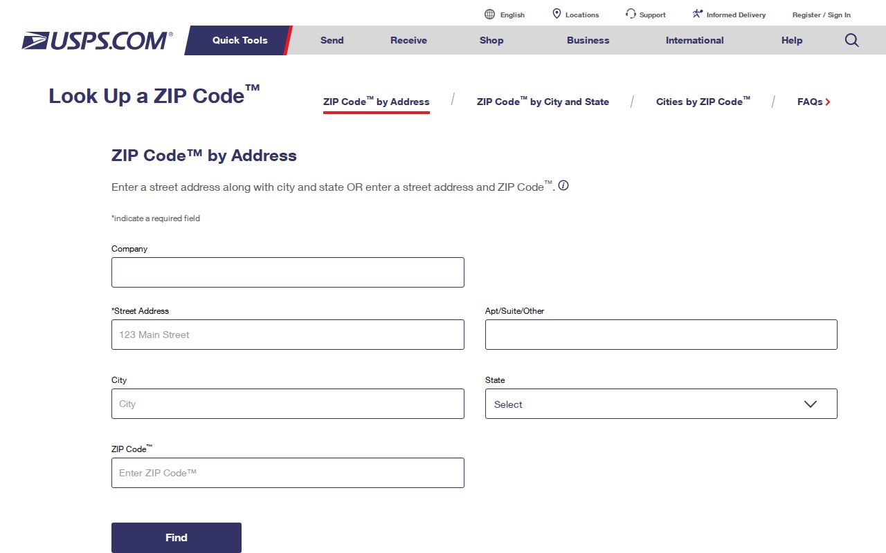
The postal response helps normalize delivery formatting. It does not establish who lives at the location, who owns it, or whether its ZIP follows a township boundary.
Cherry Hill ZIP Code Directory Search Path
A ZIP alone is too broad for a property or person record search. The documented local method begins with postal standardization, then shifts to the verified address and parcel tools. This keeps the postal workflow focused on routing geography and avoids claiming an unverified local filter.
- Use USPS By Address with the street, city, and state, then record the standardized address and ZIP with the date checked.
- Locate that street address or its block and lot in the Cherry Hill Public Information Map and keep the parcel and map context.
- Use the same address or block and lot in the SDL property and permit route, where those fields are documented.
- Compare assessment, owner, and sales context in the Camden County Assessment Data Hub, without assuming an unverified ZIP search control.
- For recorded property questions, use the municipality and legal description in the Camden County Clerk index, then check instrument dates and party roles.
When the task becomes a road-by-road comparison, the Cherry Hill Township street directory provides the address and parcel sequence. A ZIP is a useful first grouping, but it should not replace the individual address.
ZIP Filters Not Verified in Cherry Hill
The local portals reviewed do not provide a confirmed ZIP search route. SDL documents street or street address, block and lot, permit or control number, location, keywords, work type, status, proposed-use group, and issued-date filters. Its published screen does not establish a ZIP filter. The Camden assessment hub is described as covering assessment, owners, and sales data, but its live field labels were not exposed in the research.
The Cherry Hill SDL advanced search is the documented fallback when a standardized ZIP needs to be turned into an address, street, or block-and-lot query.
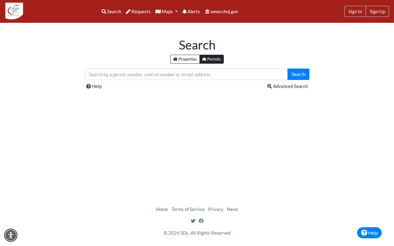
The fields visible on the SDL route support address-based follow-up. Not all permits are available, and watch-permit, important-date, property-information, and interactive-map features can require login.
Note: Do not turn an unverified portal field into a ZIP-wide list; use the displayed address and parcel controls instead.
From ZIP Code to a Cherry Hill Parcel
After USPS supplies the current formatting, the Public Information Map is the geographic bridge. The township describes it as a searchable, township-wide viewer for tax maps, parks, playgrounds, schools, and amenities. Its precise live address syntax and parcel pop-up fields were not captured in the research, so use the visible controls on the current map rather than relying on a presumed search format.
From there, the County Board of Taxation’s assessment and mapping route describes assessment, owner, sales, land-detail, specific-property, and 200-foot-list functions. The 200-foot-list description is a mapping function, not proof of a ZIP boundary or a complete street roster. A current owner may be an entity, trust, estate, or multiple people, and an assessment record is not proof of occupancy.
For a record after 1978, the Camden County Clerk online property-records index adds recorded party and instrument context. Its coverage date is an online-index boundary, not the beginning of local deeds.
ZIP Codes and Cherry Hill Township Limits
ZIP codes are postal delivery geography, not legal township lines. The official township source is the reliable basis for the three verified local ZIPs. A city label returned by USPS can be useful mailing information while still differing from the jurisdiction that holds a tax map, permit, deed, or election record. Keep municipality, mailing city, ZIP, and county in separate fields when comparing sources.
No reviewed source identified a Cherry Hill enclave, a current street-numbering manual, a townshipwide historic readdressing list, or an exact neighborhood-by-ZIP map. When a result looks unusual, compare the street address, block and lot, parcel map, mailing city, and source date rather than trying to resolve it with a ZIP alone.
Historic comparison raises a separate boundary issue. A record before 1961 may say Delaware Township, while a later postal field uses Cherry Hill. That name change does not prove that road labels, parcel lines, or delivery labels are identical across time. Preserve the locality wording used by the original source, its date, road form, and legal description. Then compare those facts with a map plate or block-and-lot context. Township history and current maps can test a location, but neither replaces the dated record being compared.
Cherry Hill Postal Routing Examples
The 2026 USPS Postal Bulletin gives a useful warning against treating a routing label as municipal coverage. Its examples pair 08002 and 08034 with Cherry Hill 08002, and pair 08003 and 08033 with Cherry Hill 08003. The township’s three-ZIP statement remains the evidence for local coverage. The bulletin’s appearance of 08033 is a routing comparator, not evidence that 08033 is a Cherry Hill Township ZIP.
Ellisburg’s USPS station is listed at 600 Kings Highway North, Suite 1, in 08002. The Cherry Hill Post Office is listed at 1175 MarlKress Road in 08034. Those station labels help check a postal reference, but neither station listing supplies a full boundary map for the ZIP.
Note: Record the postal source and date with a routing result because labels and local delivery details can change.
Historic Cherry Hill ZIP Code Searches
Older records need a different search vocabulary. ZIP codes were not part of pre-1963 addressing, and a pre-1961 Cherry Hill record may use Delaware Township. Cherry Hill Public Library history says voters approved the present name in 1961 after a postal-name conflict. For a historic deed, map, newspaper, or directory, keep the original road spelling, village or route language, source date, and the township name used by the source. Modern USPS output is a comparison tool, not a replacement for historical wording.
Cherry Hill Public Library local-history material identifies terms such as Ellisburg, Erlton, Colwick, Locustwood, Kingston Estates, Greenhaven, Barclay Farms, and Cherry Hill Estates. Those place names can help bridge an old address to a current map, but they do not prove a present ZIP edge. For an older property trail, compare map plate, road intersections, legal description, and block or lot.
Cherry Hill ZIP Code Glossary
Postal terms are short, but they describe different routing ideas. Keeping them distinct helps prevent a postal search from being used as a property conclusion.
- ZIP code
- A postal routing code for an address or locality. It is not a municipal-boundary designation.
- ZIP+4
- An added delivery segment used with a five-digit ZIP to refine mail routing for a particular address range or destination.
- PO-box ZIP
- A ZIP used for post-office boxes. No verified Cherry Hill Township example was located in the reviewed research.
- Unique ZIP
- A ZIP assigned to a single organization or destination. No verified local example was located in the reviewed research.
- Carrier route
- A postal delivery grouping. It is a mail-routing concept, not a government district or resident list.
The practical rule is simple: use the postal directory to standardize and narrow an address, then use the relevant township or county record system for the parcel, permit, deed, or civic record needed.